Northridge: A Case Study of an Urban Earthquake
In the early morning hours of January 17, 1994, most residents of Los Angeles were still asleep. At 4:30 that morning, a major earthquake hit the area. The ground shook violently over a large region. Frightened residents ran into the streets. Soon fire trucks were racing to fires caused by broken gas mains. Rescue teams were struggling to reach people trapped in collapsed buildings. It was a scene of widespread chaos.
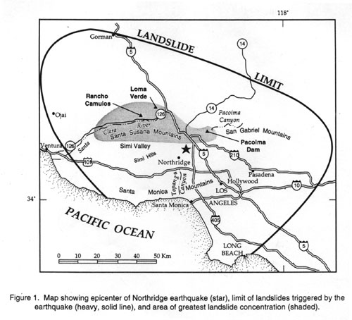
The magnitude 6.7 Northridge earthquake-with an epicenter just north of Los Angeles and lasting just 15 seconds-was one of the costliest natural disasters in U.S. history. Around 9000 people were injured, some 1600 of these seriously, and 57 people were killed. Over 22,000 people were displaced from their homes. The region suffered an estimated $40 billion in economic losses. Thousands of buildings were damaged or condemned. Nine hospitals were closed, with 2500 beds lost. Nine parking garages collapsed. Portions of eleven major roads were impassable. Sections of seven freeways collapsed and 170 bridges were damaged to some extent.
This case study of an “urban earthquake,” considers scientific observations related to the earthquake, the consequences of the earthquake, and why variations in earthquake hazard exist within a seismically active region such as Los Angeles, using the tools of a geographic information system (GIS). Students explore not just what scientists know about earthquake hazards but how they know what they know.
Investigations and Learning Goals
All data and projects are available for download below.
The case study has four components and learning foci:
Earthquakes and you
Students reflect on the impact a major earthquake could have on them. What if there were no electricity, water, or heat available for one or more days? How might you plan for it and respond to it?
Before the earthquake
As a result of this investigation, students will be able to describe the tectonic setting and origin of seismicity in southern California. Students explore the tectonic setting within which the Northridge earthquake took place and begin to get a feel for why it occurred where it did. Why is southern California a seismically active region? What accounts for the pattern of seismicity? Where have large earthquakes like Northridge occurred historically? And what accounts for the complex network of active faulting that characterizes the region?
After considering these questions within a regional tectonic framework, they examine the concepts of earthquake hazard and associated risk. Then they develop a qualitative analysis of hazard and risk for the Los Angeles region before the Northridge earthquake, based on patterns of active faulting and historical seismicity up to that time. Later, after learning where the earthquake occurred, they examine the extent to which the earthquake’s location was consistent with their analysis.
The Earthquake
In this activity, students use triangulation to determine the location of the earthquake and explore the events that occurred in the hours and days following the earthquake. They examine the pattern of aftershocks and determine the strike and dip of the fault plane.
The Aftermath
The damage from the Northridge earthquake was widespread and in some areas severe. Some areas suffered almost total destruction, yet others had minimal damage. In this investigation, students explore the factors that influence the distribution and degree of damage. Using geologic, liquefaction zone and sedimentary thickness maps, along with peak ground acceleration (PGA), Modified Mercalli Intensity and data on the damage levels for over 25000 buildings, they begin to understand the relationships among PGA, geology and damage. As a closing activity, students use the many datasets they have explored to generate a revised estimate of zones of elevated earthquake hazard and risk and compare it to their original interpretation.
Target Learning Audience
The case study is designed for lower division undergraduate students in a geology, earth science, hazards or environmental science course. It could also be used by geoscience majors taking a structural geology, geophysics or hazards course. It assumes the students have been introduced to plate tectonics, earthquakes and faulting, and basic sedimentary depositional processes. No prior experience with a GIS is required, as all instructions are provided.
Teaching Tips
The case study can be completed in two full lab periods or a mix of homework time and one lab period, depending on how and when it is used in a course. The first activity (Earthquakes and you) could be used in class in a Think-Pair-Share activity at the beginning of a lecture on earthquakes. The complete case study could also be used as a semester project, with the students exploring pieces of the case study over the course of the semester or as a wrap up to the semester. The case study contains full instructions for the user, as we assume neither the instructor nor the student has prior experience with a GIS.
Download the Student Projects and Data for ArcGIS9
Instructors may request the Instructor version which has suggested answers for the units by contacting hall at scieds.com
Feedback
The authors would greatly appreciate any feedback users have on how to effectively use the case study in a specific course and input on how to improve the materials overall. Send email to hall at scieds dot com
 This material is based upon work supported by the National Science Foundation under Grant Number DUE-0521936. Any opinions, findings, and conclusions or recommendations expressed in this material are those of the authors and do not necessarily reflect the views of the National Science Foundation.